
Valgrande Forests Route
- Lena Asturias Centre
- Distance: 10,7 kms
- Difficulty: Half
- Altitude: 1.150 m.
- Unevenness: 292 m.
- On foot: 6 h. 30 min. Round trip
- Start point: Payares/Pajares
- Tour type: Round trip
- Layout of the route: Download kml, Download gpx
Route
Payares/Pajares - Forest of Valgrande 21
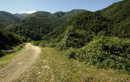
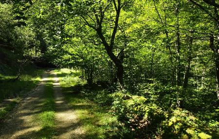
This beautiful route begins on the road that leaves the village of Payares/Pajares, where, approximately one kilometre further on, we will find on our right the downhill track that we must take to begin our route.
After the first kilometre, a path appears on our left, but we ignore it and continue along our path. Along the way you will come across different types of trees, such as willows and various species of oak. A kilometre further on we pass the Mayarín stream, from which point the path, surrounded by penetrating forest on both sides, becomes a little steeper.
At around kilometre 3 we cross the Camino de Santiago that goes to Samiguel/San Miguel del Río, a clearly visible area where we can see some abandoned houses, Panizaliega and La Casona; obviously, we continue along our path.
About 300 metres further on, we cross the Puerto stream, from where we can enjoy a wide view of the Parador Nacional de Pajares, situated above the valley of Los Hayedos. Another 200 metres further on, we come to the Las Mestas stream, which rises in the Cuitu Negru. Along the way we can see other types of trees, such as birch and yew.
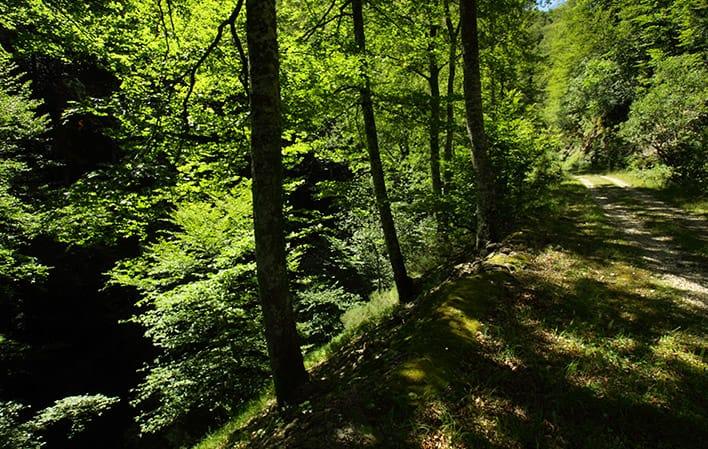
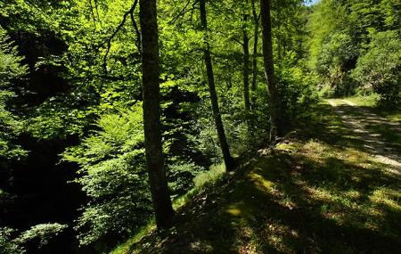
When we have walked about 6 kilometres, our path runs parallel to the Valgrande river and here we find the beech trees, the kings of this beautiful forest. When we reach kilometre 8.5, we cross the river on its left bank, which we will follow until we reach the vicinity of the Negrón tunnel, the end point of our route.
Map
Detail
This beautiful route begins on the road that leaves the village of Payares/Pajares, where, approximately one kilometre further on, we will find on our right the downhill track that we must take to begin our route.
After the first kilometre, a path appears on our left, but we ignore it and continue along our path. Along the way you will come across different types of trees, such as willows and various species of oak. A kilometre further on we pass the Mayarín stream, from which point the path, surrounded by penetrating forest on both sides, becomes a little steeper.
At around kilometre 3 we cross the Camino de Santiago that goes to Samiguel/San Miguel del Río, a clearly visible area where we can see some abandoned houses, Panizaliega and La Casona; obviously, we continue along our path.
About 300 metres further on, we cross the Puerto stream, from where we can enjoy a wide view of the Parador Nacional de Pajares, situated above the valley of Los Hayedos. Another 200 metres further on, we come to the Las Mestas stream, which rises in the Cuitu Negru. Along the way we can see other types of trees, such as birch and yew.
When we have walked about 6 kilometres, our path runs parallel to the Valgrande river and here we find the beech trees, the kings of this beautiful forest. When we reach kilometre 8.5, we cross the river on its left bank, which we will follow until we reach the vicinity of the Negrón tunnel, the end point of our route.