Percurso nos arredores de Grandas

- Grandas de Salime Astúrias ocidental
- Distância: 11,4 kms
- Dificuldade: Fácil
- Desnível acumulado: +260 m
- Desnível acumulado: --260 m
- Altitude máxima: 726 m
- Altitude mínima: 543 m
- IBP index: 42
- Modalidade: Caminhantes
- Tipo percurso: Circular
- Tipo de rota: Montanha
- Retorno de Comboio: Não
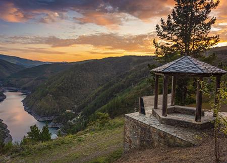
O percurso atravessa bosques de carvalhos e pinheiros, aldeias de arquitetura popular e oferece vistas da barragem de Salime. Termina no Museu Etnográfico, autêntica referência da cultura do sudoeste asturiano e ponto de referência para conhecer o mundo rural asturiano.
Percorrer este itinerário por Grandas de Salime é mergulhar na essência rural do oeste asturiano, onde a paisagem, a história e a etnografia se entrelaçam de forma natural. Este percurso, simples e acessível, começa na localidade de Grandas e percorre caminhos florestais, pequenas aldeias e zonas arborizadas que oferecem amplas vistas da barragem e das serras vizinhas.
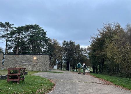
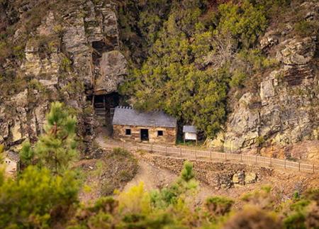
O percurso começa junto ao Museu Etnográfico de Grandas de Salime, ponto de referência essencial para conhecer a cultura camponesa asturiana. A partir daí, tomamos um caminho junto à casa de Ferreiro e subimos em direção ao monte Coto. À medida que ganhamos altura, a paisagem abre-se entre bosques de carvalhos e pinheiros, oferecendo-nos uma vista impressionante da barragem de Salime, onde se encontram os rios Navia e Oro.
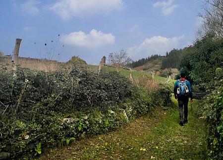
No cimo do monte, o caminho dirige-se para a aldeia de Robledo. Ao longo do caminho, é fácil encontrar vestígios da fauna local: roncos de javali, o rasto de um corço, o som dos pica-paus ou os ninhos escondidos entre as árvores. O ambiente transmite uma sensação de quietude rural, reforçada pelas construções tradicionais que pontuam a paisagem.
A partir de Robledo, continuamos por uma pequena estrada até sairmos em direção a Escanlares, embora não entremos na aldeia. Antes disso, viramos à direita para entrar num pequeno bosque que nos leva até A Farrapa (ou La Farrapa), onde o caminho coincide brevemente com a estrada AS-28. Este troço faz a ligação com uma queijaria local, Monteverde, exemplo da vitalidade das tradições agro-alimentares do sudoeste asturiano.
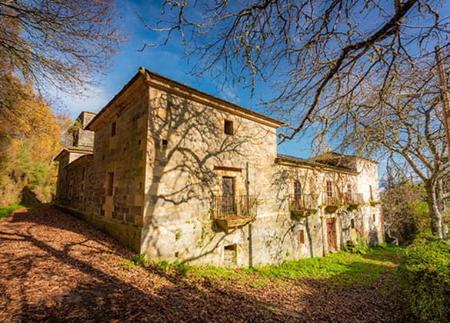
O caminho volta a entrar na floresta. Ao quilómetro 6, voltamos a um caminho que nos leva, sem desvios, à aldeia de Santa María. Esta aldeia rural conserva várias casas brasonadas do século XVIII, pertencentes a famílias como a dos Ron, Magadán e Suárez, testemunho de um passado ligado à pequena nobreza local.
O percurso dirige-se para o seu final, percorrendo um troço da estrada AS-12. Pouco antes do quilómetro 10, uma bifurcação da estrada conduz-nos ao ramal da direita, completando o círculo após 700 metros de caminho que nos leva de volta a Grandas de Salime.
Este passeio é um convite a descobrir a paisagem de suaves colinas e encostas arborizadas que rodeiam a vila, combinando património, natureza e vida rural num ambiente onde o tempo parece andar a outro ritmo. Um percurso perfeito para quem procura passeios tranquilos com conteúdo cultural e paisagístico.
PR-AS 108
Conselhos básicos antes de ir para as montanhas
- Se for com um cão, mantenha-o sempre preso por uma trela.
- Evitar aproximar-se do gado.
- Se encontrar mastins a proteger o gado, não se aproxime deles, não lhes faça festas e não os alimente. Não permita que o sigam ou que se afastem do rebanho. Eles estão a trabalhar.
- Não deixe rasto. Recolha todos os seus resíduos, incluindo os orgânicos. A natureza não é uma lixeira.
- Agir com prudência. Planeiebem o seu percurso, leve tudo o que precisa e certifique-se de que está adaptado às suas capacidades físicas.