

Route Santibáñez - Santibáñez
- Aller Asturias Centre
- Distance: 4,1 kms
- Difficulty: Short
- Code: PR236
- Altitude: 748 m.
- Unevenness: 154 m.
- On foot: 1 h. 30 min.
- Start point: Santibanes de Murias
- Tour type: Circular
- Layout of the route: Download kml, Download gpx
Info
Cannot be done with a pushchair/stroller, but can be done with a mountain bike.
Route
Santibanes de Murias - Santibanes de Murias 3,775
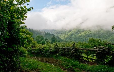
The route starts in Santibanes de Murias, a village with beautiful views, surrounded by native forest. We start the route by taking the road that leads to the village and we soon come across the signpost that indicates the start of the route.
Here we begin the ascent along the path that comes off to the right of the road. We continue without turning off until we reach Vil.lar, a pretty village that we have to cross in a north-easterly direction until we reach the track that gives access to numerous meadows and which has a steep slope.
We start the climb and very soon we will find a crossroads, where we will take the one on the right. We continue along the royal path that connects the villages of Vil.lar and Santibanes de Murias. We pass the sites of Viscayana, El Premalayo and El Carrescu, without deviating from the main path, which leads to a track where we start a steep descent that takes us back to the starting point.
ACCESS:
The start of the route is located in the village of Santibanes de Murias, which can be reached by the AE-3 road from Moreda.