
Archdeacon's Path
- Amieva Eastern Asturias
- Distance: 10,4 kms
- Difficulty: Half
- Code: GR201
- Altitude: 1.531 m.
- Unevenness: 948 m.
-
On foot:
6 h.
Only one way
- Start point: Amieva
- Tour type: Crossing
- Layout of the route: Download kml, Download gpx
Info
A former gateway between Asturias and León, this route linked Cangas de Onís with Soto and Oseja de Sajambre via Amieva, the Toneyu valley and Portillo de Beza.
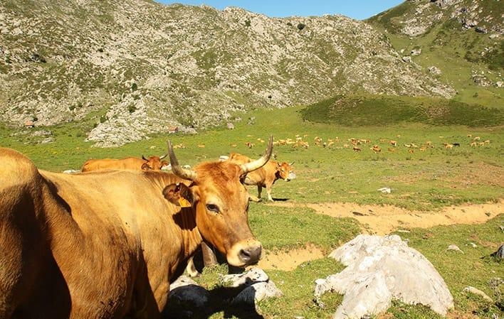
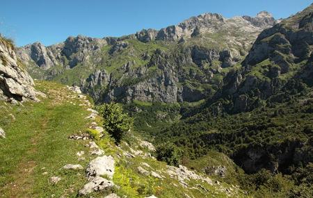
This route runs between the latter point and Amieva at the western end of the Picos de Europa National Park. It is a route of great landscapes, dominated by the Canto Cabronero, the valley of Angón and the walls that plunge in front of us from the viewpoint of Ordiales. A route of pastures and limestone with open valleys and sheepfolds.
But it is also a route of wild nature, where you can see chamois running down the slopes, or a group of vultures feeding on a dead horse. It is a route of sensations, of peace and quiet, of sitting and listening to the silence along this ancient stone route laid out like a royal road.
Perhaps the jewel in the crown is the Toneyu, declared a Natural Monument and Site of Community Importance. As well as being a Special Protection Area for Birds, within the National Park, it is a network of galleries up to 600 metres deep and 19 kilometres in total excavated by water in the rock.
Route
Amieva - Portillo de Beza 11,7
The route is a section of the Senda del Arcediano, an ascending route that takes us to Portillo de Beza, on the border between Asturias and Castilla y León. It starts in the town of Amieva, from the northern end of which we set off. We will pass two forks: at the first, take the path to the left, and at the second, the path to the right.
After the first 1.5 kilometres, we reach the La Collada viewpoint, where we must continue to the right, to take the San Román path. We do not have to turn off onto any of the side paths that leave this path until we reach the Angón valley.
After about 3.3 kilometres from the previous point, kilometre 4.80 from the start of the route, we come to another fork. The path to the left leads to the Jocica path and the Dobra river down the Angón valley. We must take the path on the right, to continue ascending through the middle of a huge forest.
At kilometre 7.20 of the route, we find ourselves at the Saúgu sheepfold; from this point we have magnificent views of Canto Cabronero, the Ordiales viewpoint and La Torrezuela. After two kilometres, the ascent to the Beza pass begins.
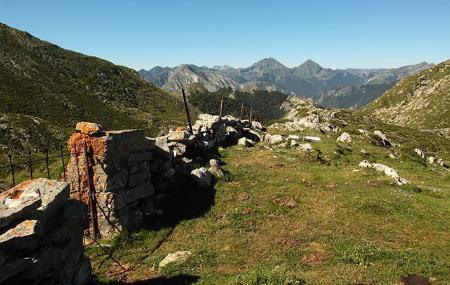
Almost at the end of our route, at kilometre 10.5, on our right we pass the Valdepino peak and in the valley the Red de Toneyu, declared a Natural Monument of the Principality of Asturias. In the last kilometre we reach the border with León, which is the highest point of this section of the Senda del Arcediano. The end of our route is 200 metres further on.
Map
Detail
The route is a section of the Senda del Arcediano, an ascending route that takes us to Portillo de Beza, on the border between Asturias and Castilla y León. It starts in the town of Amieva, from the northern end of which we set off. We will pass two forks: at the first, take the path to the left, and at the second, the path to the right.
After the first 1.5 kilometres, we reach the La Collada viewpoint, where we must continue to the right, to take the San Román path. We do not have to turn off onto any of the side paths that leave this path until we reach the Angón valley.
After about 3.3 kilometres from the previous point, kilometre 4.80 from the start of the route, we come to another fork. The path to the left leads to the Jocica path and the Dobra river down the Angón valley. We must take the path on the right, to continue ascending through the middle of a huge forest.
At kilometre 7.20 of the route, we find ourselves at the Saúgu sheepfold; from this point we have magnificent views of Canto Cabronero, the Ordiales viewpoint and La Torrezuela. After two kilometres, the ascent to the Beza pass begins.
Almost at the end of our route, at kilometre 10.5, on our right we pass the Valdepino peak and in the valley the Red de Toneyu, declared a Natural Monument of the Principality of Asturias. In the last kilometre we reach the border with León, which is the highest point of this section of the Senda del Arcediano. The end of our route is 200 metres further on.