

Villar de Gallegos - Alto del Cordal route
- Mieres, Lena and Riosa Asturias Centre
- Distance: 4,3 kms
- Difficulty: Short
- Altitude: 803 m.
- Unevenness: 332 m.
-
On foot:
1 h. 30 min.
Round trip
- Start point: Viḷḷar
- Tour type: Round trip
- Layout of the route: Download kml, Download gpx


Info
The valley of Cuna y Cenera is another example of a hidden gem in the Caudal basin that is worth discovering, and what better way to do so than by approaching Viḷḷar and from here walking up to the Cordal to get to know the upper part of the valley.
On the ascent to the Cordal, we can see how the vegetation gradually changes; we leave the orchards of Viḷḷar to enter a mixed forest dominated by chestnut and oak trees, dotted with the occasional elm, and where, as we climb, birch and willow trees take over.
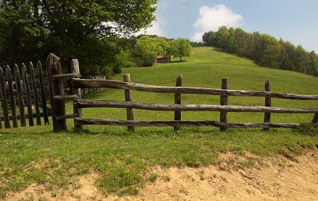
Some small streams of water cross under our path, and ash trees appear next to the huts and the perimeter fences of the farmsteads made of wood, in the old style.
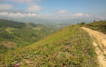
As we approach the Cordal, the horizon widens, opening up not only to the valley of Mieres, but also to Lena, Riosa and, of course, the imposing Aramo and, in the distance, the ascent to the Angliru.
Route
Viḷḷar - Alto del Cordal 4,4
This short route begins in the small village of Viḷḷar, which can be reached through the Cenera valley by going up the MI-4 road.
We leave Viḷḷar along an ascending track, oriented towards the south, which runs through a wooded area, where, after approximately 2.2 kilometres, another path comes together, which we ignore in order to continue straight on along our path.
About 800 metres further on, kilometre 3, we turn left and continue straight on for another kilometre, turning off to our right. After a few more metres, we finally reach the Cordal, the final point of our route, where we can enjoy the beautiful views offered by this high point.
Map
Detail
This short route begins in the small village of Viḷḷar, which can be reached through the Cenera valley by going up the MI-4 road.
We leave Viḷḷar along an ascending track, oriented towards the south, which runs through a wooded area, where, after approximately 2.2 kilometres, another path comes together, which we ignore in order to continue straight on along our path.
About 800 metres further on, kilometre 3, we turn left and continue straight on for another kilometre, turning off to our right. After a few more metres, we finally reach the Cordal, the final point of our route, where we can enjoy the beautiful views offered by this high point.