

- Lena Asturias Centre
- Distance: 4,3 kms
- Difficulty: High
- Altitude: 2.417 m.
- Unevenness: 1.201 m.
-
Climb:
4 h.
One way
- Geographic situation: Cantabrian Mountain Range (Lena-La Babia).
- Start point: Tuiza de Arriba
- Layout of the route: Download kml
The hardest stretch of the climb up to Peña Ubiña begins in Tuiza de Arriba, situated at an elevation of 1,210 m.
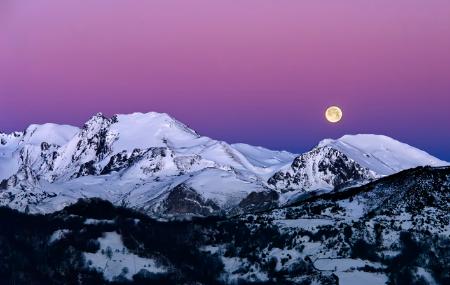
In Tuiza de Arriba, located at an altitude of 1,210 m, the hardest walk to Peña Ubiña begins. Tuiza de Arriba is situated very close to km 17 of the LE-8 Campomanes-Puerto de la Cubilla road.
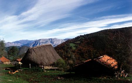
The hardest stretch of the climb up to Peña Ubiña begins in Tuiza de Arriba, situated at an elevation of 1,210 m. Take the upper path heading west to quickly gain altitude. As you approach the stream, the north face of the huge Peña Ubiña Massif rises up before you. Continue on through the high meadows of Boquera de Meicín up to Vega del Chagu river meadow (1,545 m). The Centro Cultural Mierense mountain shelter is nearby, serving as a base camp for carrying out several climbs in these mountains.
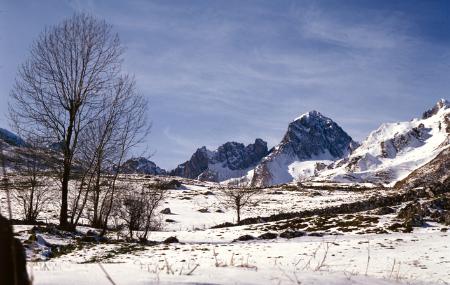
Continue southward via a steep path up the slope that leads to Collado de Terreos col (1,933 m). From there you can see the dividing line between the boroughs of Mieres and Lena, and the boundary between Castile-León and Asturias, a line defined by a stake fence that runs up the buttresses of Peña Ubiña, on one side, and Peña Cerreos Crag, on the other.
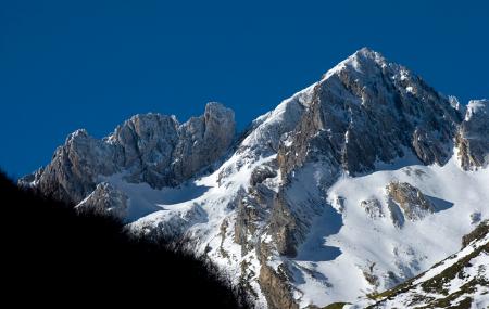
Vega de Riotuerto meadow, where Peña Ubiña Pequeña is located, extends to the south. The huge Peña Ubiña extends towards Collado de Ronzón col, showing the many folds of its east face. The closest couloir, called Canal de la Fana, holds one of the most direct climbs to the summit, for experienced mountaineers only. After overcoming the rocky obstacles and unstable screes in this couloir, you reach the summit, where there is a trig point and summit box.
Another, somewhat easier climb continues from the edge of the meadowland, skirting the crag along the top of the Vega del Chagu meadow until reaching Collado Ronzón col (2,000 m). From there, you climb the meadow and then the overlapping couloirs to the summit of Peña Ubiña. Continue along the top northward to enjoy the views from there.
Tuiza de Arriba - Peña Ubiña 4
In Tuiza de Arriba (Lena), situated at an altitude of 1,210 m, the hardest walk towards Peña Ubiña begins. We take the upper path that goes westwards, gaining altitude quickly. As we approach the stream, the great mass of Peña Ubiña emerges on the north face. We continue our walk through the meadows of Boquera del Meicín until we reach Vega del Chagu (1,545 m.). In the surrounding area is the mountain refuge of the Mierense Cultural Centre, which serves as a base for several ascents in these mountains.
We continue southwards up the slope that leads to the Terreos pass (1,933 m.) along a steeply sloping path. From there we can see the border between Mieres and Lena, as well as the boundary between Castile, León and Asturias, a line defined by the stakes that rise from the buttresses of Peña Ubiña on one side and Peña Cerreos on the other.
To the south lies the Vega de Riotuerto, where Peña Ubiña Pequeña is located. The great Peña Ubiña extends towards the Ronzón pass, showing the numerous folds of the eastern slope. One of the most direct routes to the summit, for experienced mountaineers, runs along the one closest to us, called Canal de la Fana. Overcoming the rocky reefs and also the unstable boulders, we reach the summit via this channel, where we can see a geodesic cairn and a mountaineer's letterbox.
Another climb, somewhat easier, continues from the border of pastures, skirting the crag at the head of the Vega, to the Ronzón pass (2,000 m.). From there, we climb the meadow and then the overlapping channels to the summit of Peña Ubiña. We continue along the summit towards the north to enjoy the landscape that can be seen from there.