
- Aller Asturias Centre
- Distance: 15.3 kms
- Difficulty: Half
- Code: PR266
- On foot: 5 h. 30 min.
- Start point: Bo
- Tour type: Circular
- Layout of the route: Download kml, Download gpx

Bo - Bo 15,400
The village of Bo is the starting point of the route, from the square we go back and turn off to the right along the access road to Bustiyé. Once at this point, we follow the signs for the path that lead us along the track that climbs up the so-called Quentu Marianes. We pass the 11º de Marianes, whose name refers to the floor of the extinct mountain mining operation that once existed in the area. We start to gain height and pass Quentu Cazurrín and, in a short time, we enter the beech forest of El Faillín, where the path becomes less steep, and we continue until we reach Otos.
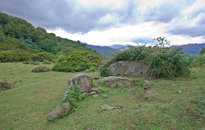
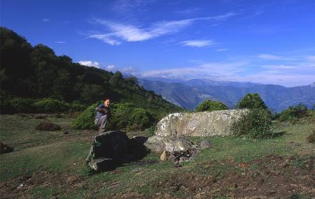
From this point, and without leaving the main path, we continue on to La Carrera. We begin a climb that takes us back to Quentu les Cruces and we turn off to the left to reach El Padrún, at an altitude of 1,195 metres, where we can contemplate the Megaliths of El Padrún, a necropolis from the Neolithic period. From here we start the descent returning to Quentu les Cruces and then take the path that takes us to the Espines sheepfold, along the route of the Carisa Way. The downhill path follows several twists and turns until we reach Los Fueyos, where we follow the track that leads us to Les Cruces.
We turn off to the right along the track that goes up from Estrada to 7º de Melendreros, taking the turning to the right through La Pruvía and Puenxo to reach Bo, the end of our route.
ACCESS:
The village of Bo is the starting point of this route, which can be reached by the AE-2 road from the village of Moreda.
- PR266
- Cannot be done with pushchair/stroller.
- It can be done by mountain bike (medium-high difficulty. It runs along a mountain track).