Percorso frontale di Nalon

- Distanza: 19,55 kms
- Difficoltà: Difficile
- Dislivello cumulativo: +770 m
- Dislivello cumulativo: -770 m
- Altitudine massima: 601 m
- Altitudine minima: 356 m
- Indice IBP: 79
- Modalità: Alpinisti
- Tipo di percorso: Circolare
- Tipo di percorso: Montagna
- Ritorno in treno: No
- Punto di partenza: Area ricreativa Degollada
- Punto di arrivo: Area ricreativa Degollada
- Epoca: Tutto l'anno
- Durata stimata: Più di 5 ore
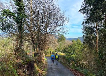
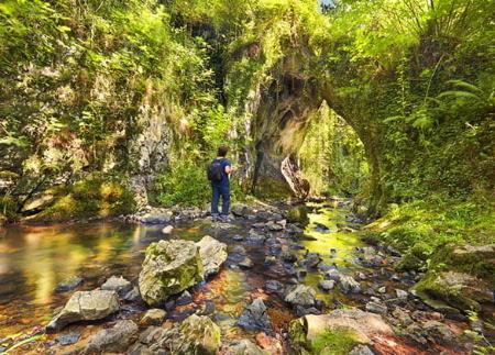
L'Itinerario del Fronte di Nalón, nel comune di Candamo, è un percorso storico e naturalistico che permette di scoprire le tracce della guerra civile spagnola nel paesaggio della sierra, dove si conservano ancora trincee, nidi di mitragliatrici, casematte e postazioni di artiglieria che facevano parte delle difese repubblicane del fronte asturiano nel 1937. Tre diverse sezioni, che possono essere percorse insieme o indipendentemente, offrono la possibilità di esplorare uno dei migliori esempi di archeologia militare contemporanea delle Asturie, godendo allo stesso tempo di uno splendido ambiente naturale.
Il percorso si snoda attraverso boschi di pini, eriche e ginestre, prati alti e aree aperte che si affacciano sulle valli circostanti. Nel cielo, il volo dei rapaci accompagna spesso l'avanzata lungo i crinali. Lungo il percorso, pannelli informativi aiutano a interpretare i resti difensivi e il ruolo svolto da queste postazioni nel conflitto.
Sezione 1: Le trincee di Las Fontes e Pie de la Sierra
Il primo tratto, circolare e lungo circa 5 chilometri, inizia nel parcheggio dell'Alto de la Sierra, ma può essere iniziato anche nell'area ricreativa di La Degollada. Lungo un sentiero che attraversa i boschi del versante di Candamo, il percorso sale fino alla cima di La Cotera e alle trincee di Las Fontes, che difendevano il passo strategico verso Avilés. Il percorso prosegue fino all'Altu de La Llinar, dove si trovano nuove trincee e un tumulo neolitico, testimonianza dell'occupazione umana di questa catena montuosa fin dalla preistoria. Il percorso ritorna quindi al punto di partenza, passando per il profondo taglio difensivo di Pie de la Sierra, dove le trincee scavate nella roccia sono in ottimo stato.
Tratto 2: Le batterie di artiglieria e gli osservatori
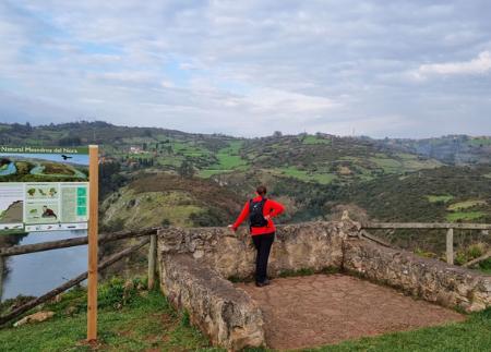
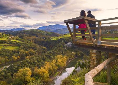
Il secondo tratto, lungo circa 3,5 chilometri, si snoda lungo la pista dei mulini a vento, in un paesaggio più aperto e crestato. Qui spiccano le batterie di artiglieria dell'Alto de los Cañones, con le loro grandi casematte di cemento, costruzioni caratteristiche delle fortificazioni repubblicane nelle Asturie. Visitiamo anche l'osservatorio dei Picos de Horru e il trinceramento di Pico la Cruz, da cui si possono ottenere alcune delle migliori viste della zona circostante.
Sezione 3: Il labirinto di trincee di El Pedroso
Il terzo tratto, considerato il più spettacolare, parte dall'area ricreativa di La Degollada e si addentra nella foresta verso la Cima del Pedroso, dove si conserva un autentico labirinto di postazioni difensive: nidi di mitragliatrici, pozzi per tiratori scelti, ripari scavati e rifugi blindati. L'atmosfera ombrosa della pineta e la presenza di questi elementi militari rendono questo tratto un'esperienza immersiva unica. Il percorso termina nel villaggio di Villar, dopo aver attraversato il crinale e seguito il tracciato della linea fortificata.
- Segnaletica propria
Consigli di base prima di andare in montagna
- Se andate con un cane, tenetelo sempre al guinzaglio.
- Evitare di avvicinarsi al bestiame.
- Se trovate dei mastini che proteggono il bestiame, non avvicinatevi, non accarezzateli e non date loro da mangiare. Non permettete loro di seguirvi o di allontanarsi dalla mandria. Stanno lavorando.
- Non lasciate tracce. Raccogliete tutti i vostri rifiuti, compresi quelli organici. La natura non è una discarica.
- Agite con prudenza. Pianificate bene l'itinerario, portate con voi tutto il necessario e assicuratevi che sia adeguato alle vostre capacità fisiche.