
- San Martín del Rey Aurelio Asturias Centre
- Distance: 3,6 kms
- Difficulty: Short
- Altitude: 251
- Unevenness: 89
-
On foot:
1 h.
Only one way
- Start point: Sotrondio
- Tour type: One way
- Layout of the route: Download kml, Download gpx

This route is the confirmation that the Asturian mining basins still jealously guard precious secrets, authentic jewels, as is the case of this route.
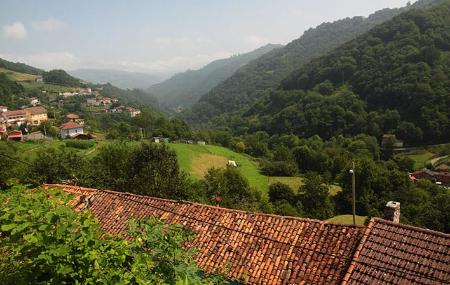
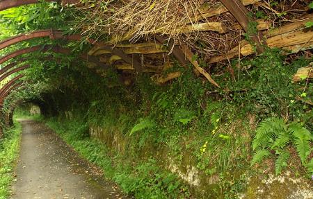
Here mining lives in harmony with nature, the mines are hidden in the woods and hardly leave a trace in the landscape, a landscape perforated by the river that opens up the valley, on whose right bank we walk continuously until it flows into the Nalón.
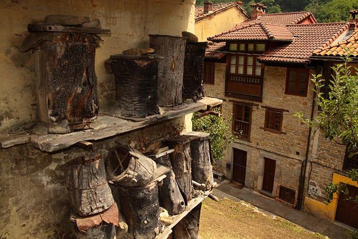
From the church of Santa Bárbara we walk through a world of tradition in which a few metres from the church we can see "casiellos" (old bee hives on a trunk), farming tools in a granary or elements of the mine to create tunnels to allow passage. All this, accompanied by blackbirds, trout or kingfishers in the middle of an almost continuous forest until we reach Sotrondio, where we can finish our route or continue along the river path.
If we go in the direction of Santa Bárbara/Santa Bárbola, we can also continue in the direction of La Colladiella.
Sotrondio - Santa Bárbara/Santa Bárbola 3,6 Km
This short route starts in Sotrondio, where we can easily park our car. Afterwards, we cross a bridge over the river Nalón and then, with great care, cross the AS-177 road, where we can see the path that we are going to use for this short route.
The route runs parallel to the Santa Bárbara river and takes us through the whole valley, leaving Miera Medio, which forms part of the Cuencas Mineras Protected Landscape, on our right, at approximately the first kilometre of the route. We continue along the Santa Bárbara valley, passing through the villages of Paniceres and La Restinga.
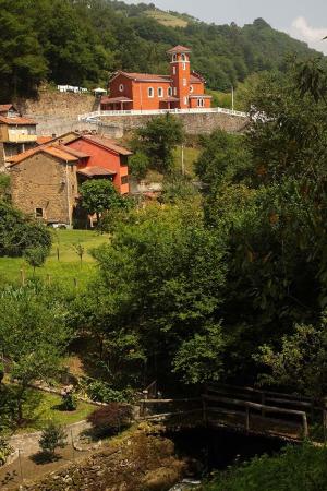
After 2.3 kilometres, we come to a monument on our left called "Prau Molín", dedicated to the miner in the mine shaft; once we have seen it, we continue on our way, which will take us the following kilometre, after crossing a road, to the church of Santa Bárbara, dating from the middle of the 18th century.
This short route starts in Sotrondio, where we can easily park our car. Afterwards, we cross a bridge over the river Nalón and then, with great care, cross the AS-177 road, where we can see the path that we are going to use for this short route.
The route runs parallel to the Santa Bárbara river and takes us through the whole valley, leaving Miera Medio, which forms part of the Cuencas Mineras Protected Landscape, on our right, at approximately the first kilometre of the route. We continue along the Santa Bárbara valley, passing through the villages of Paniceres and La Restinga.
After 2.3 kilometres, we come to a monument on our left called "Prau Molín", dedicated to the miner in the mine shaft; once we have seen it, we continue on our way, which will take us the following kilometre, after crossing a road, to the church of Santa Bárbara, dating from the middle of the 18th century.