

- Nava and Piloña Eastern Asturias
- Distance: 17 kms
- Difficulty: Short
- Code: GR105 - Pilgrimage Route
- On foot: 5 h.
- Start point: Alto del Espinadal
- Tour type: Crossing
- Layout of the route: Download kml
GR105 - Pilgrimages Route - Stage 3
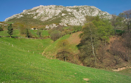
This is the first stage where we leave the villages and enter the mountains, walking entirely along a track that runs along the eastern slopes of Peñamayor, alternating between pastures and wooded areas, crossing small huts dotted with cabins, and contemplating deep valleys, but all of it with excellent views of the beautiful landscapes through which it passes. The first part runs along the northern slope, with the wide plains of the central area of Asturias below us. From the place known as Les Praeres, it runs between mountains whose ridges we can see above us until the end of the route.
Alto del Espinadal - Miera 17
It starts at the Alto del Espinadal, next to the road from Nava to Bimenes, which we cross and take a road that leads us to the village of Grátila. Next to the first house, take the dirt track that goes off to our left, until the first fork where we take the path on the right, which leads us to Piloñeta, in front of some houses. Here we turn off to the left first and then turn off to the left again until we take the road coming from Nava, where we turn off to the right next to the Peñamayor bar. Here we continue downhill on a concrete track until we cross the Fuensanta river over a bridge.
At the exit of the bridge we see the mill of Para, and in front of us a farm with a stone wall and a gate, we continue along the concrete track, leaving the wall on the left. At the next crossroads, take the track on the right and begin the long ascent through twists and turns that lead to Les Praeres.
On this climb you can stop at either of the two watering holes you pass and take a break from the steep climb to contemplate the multitude of hamlets and villages below you, as well as the beautiful Palacio de la Ferrería at the bottom of the valley on your right, next to the Fuensanta river and surrounded by meadows and chestnut woods.
After passing the last watering place, which is on a bend, we reach the hill of Les Praeres, where there are some huts on the left hand side, one of which is a picnic area where we can rest from the steep climb we have had since the start of the route.
On the right hand side we have the Pico Redondo, easy to identify, towards which we head to find a crossroads which we follow along the track on the left, leaving the Pico Redondo on our right, this track starts the descent towards the valley. As you go down the track you will come across a turning to the left that leads to a hut. Continue to the right and at the other crossroads always follow the main track, ignoring all those you come across that start to ascend towards the sierra.
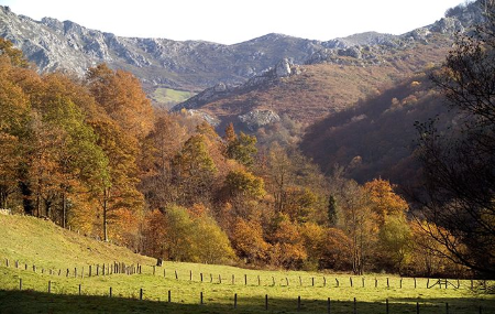
As you descend, you will come across a number of huts, which in the past must have been shepherds' huts but are now magnificent chalets. At one of the first ones you come across on the left is the La Llama bar, where you can stop and contemplate the section of the 4th stage in front of you.
Continuing along the main track and descending, we take the ravine to our right until we reach the bottom of the valley of La Muriosa, where the dirt track becomes asphalt and we have a diversion to the right that goes in the direction we were coming from.
Here we continue straight on along the tarmac and in the same direction we came from, following the tarmac track for about five kilometres we cross a stream halfway, to reach a bridge which we cross and shortly after we reach Miera, 9 kilometres from L' Infiestu, where we can take public transport.