

- Laviana Asturias Centre
- Distance: 13,6 kms
- Difficulty: Half
- Code: PR290
- Altitude: 1.074
- Unevenness: 645
- On foot: 3 h.
- Start point: Les Mestres
- Tour type: Round trip
- Layout of the route: Download kml, Download gpx
PR290
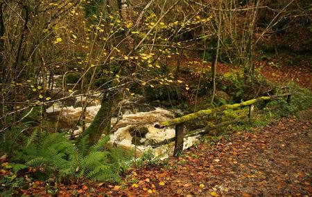
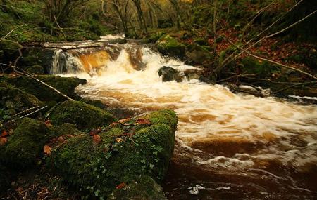
The patience and insistence of the waters of the river Raigosu have gradually opened up this gap at the foot of Peña Mea, crossing both limestone and siliceous rocks, and leaving a whole trail of canyons and waterfalls along the path that runs alongside the river.
As a result of this alternation of rocks, the vegetation changes and adapts to them, and there is a wealth of flora along the whole route, culminating in the holly groves at the top of the route. But we cannot forget the masses of hazelnut trees.
Abandon yourself to the solitude of this path, among trees, rocks and the continuous murmur of the water, sometimes closer and sometimes further away, among wild rose bushes, hawthorns, caracayos... accompanied by the trills of robins and wrens while we gradually gain height to discover small huts, old coal mines or herds of goats, it is possible on this walk towards the sky of this valley.
Les Mestres - Majada de las Casas de Raigosu 13,6
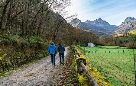
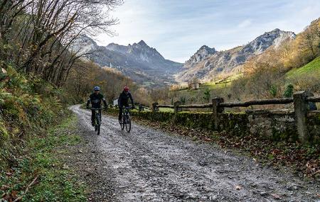
This new route starts at Les Mestres, on the LV-5 road, belonging to the council of Laviana, a little before the village of La Fomermeya. There we find the information panel about the route and a car park, where we can leave our car.
In the first 600 metres of the route, we start to walk along the track indicated by the sign. The path runs alongside the river that gives the route its name, the Raigosu, and through chestnut trees.
After 1.5 kilometres from the start, we come to a new crossroads: to the right it would take us to the village of Los Tornos, but we continue on our way to the left. Here you will also find a cave, known as Les Xanes cave. The path becomes narrower, the chestnut trees disappear and we find beech and birch trees.
Halfway along the route, kilometre 3, the Raigosu river joins the Gatu stream, and the path becomes very narrow until we come across the ruins of an old mine. We reach the narrowest and narrowest point on the route, the Foz de Cebellales.
After another 1.5 kilometres, kilometre 4.6, the path leaves the Raigosu river behind and begins to zigzag up the Collaos slope, where there is a small viewpoint and a fountain.
Approximately 6.5 kilometres further on, almost at the end of the route, you will find yourself in the "majada de las Casas de Raigosu".
This route is located in an area bordered by the great limestone walls of the foothills of Peña Mea, so we can see the famous "ojo de buey" (bull's eye).