

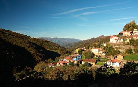
- Mieres Asturias Centre
- Distance: 13,4 kms
- Difficulty: Half
- Altitude: 660
- Unevenness: 269
-
On foot:
3 h.
Round trip
- Start point: La Güeria (Urbiés)
- Tour type: One way
- Layout of the route: Download kml, Download gpx


If you want to discover a different industrial heritage, a different mining basin, this walk between La Güeria (Urbiés) and Pozo Fortuna is undoubtedly ideal for you.
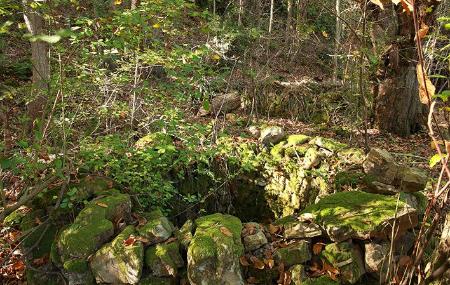
We could almost say that this route is a monument to the chestnut tree and to traditional mining, with small open pits in the middle of the mountain. Hidden among the trees we can see some of them, with the old restored wagons, like an open-air museum.
Old bridges with their rails, remains of machinery recovered and placed along the way, as well as a small museum in an old warehouse or workshop take us back to the last century.
The cabornios (a way of working the chestnut trees, pruning the branches to make the most of them) take us back to those times and beyond. The old trunks leave proof of this in their thickness, their shape, wide and open with all the branches at the same height.
And all this before arriving at the Fortuna Well, also with its own history, a history of other times that we will discover when we get there.
La Güeria (Urbiés) - Well Fortuna 13,4
The route starts in La Güeria (Urbiés). Leave from the car park located on the MI-3 road and go down a path that crosses the street. A few metres further on you will have a panoramic view of the Urbiés mountain range. Approximately half a kilometre further on, to our left, we will see the remains of the old Mosquil mining shaft. We then continue along the path.
After about 2.3 kilometres, we shall come to a river, and a little further on, at the fork, we shall have to follow the road to the right, the AS-337, whose tarmac begins about 500 metres further on.
After another 1 kilometre, we must ignore the paths that enter and leave our path and continue straight on along the road. Further on, at the height of a concrete structure, we turn slightly to the right onto a path that runs above the village of Entelosríos, along the side of the mountain and next to the river.
Almost at the end of our route, at kilometre 5.7, at the fork we take the path to the left and pass by the engine house of the old mine.
Further on, the path descends and leaves us right in front of the mine installations. A little less than 1 kilometre further on, we reach the well-known historical point of Pozo Fortuna, the end of our route.