
River Eo, Oscos and Terras de Burón
- Castropol, Taramundi, San Tirso de Abres, Vegadeo, San Martín de Oscos, Santa Eulalia de Oscos y Villanueva de Oscos Western Asturias
- Extension: 1.588 km 2
- Maximum elevation: 1,202 m. on the Pico de A Bobia peak
Images

What to see
- Interpretation Centre of the Eo Estuary - (Castropol).
- Ethnographic Ensemble of Os Teixóis and Museum of the Mills of Mazonovo (Taramundi).
- Ethnographic Museum of Esquíos (Taramundi).
- Ethnographic Ensemble of Mazonovo (Santa Eulalia de Oscos).
- Birthplace of the Marquis of Sargadelos (Santa Eulalia de Oscos).
- Ecomuseum of Bread (Villanueva de Oscos).
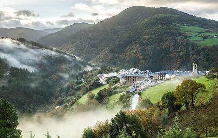
- Routes: San Martín de Oscos Green Path, Villanueva de Oscos Forest Route, Cioyo Waterfall (Castropol), Las Minas (Castropol).
- Protected areas within the Reserve: Penarronda Beach Natural Monument (Castropol and Tapia de Casariego).
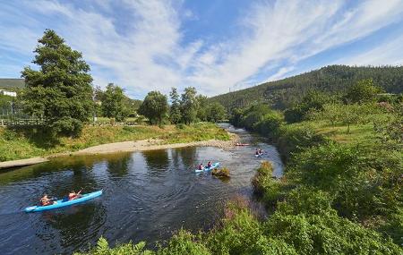
- Flora and fauna observation: Salmon farm on the river Eo (San Tirso de Abres), migratory birds in the Eo estuary (Castropol and Vegadeo), riverside vegetation and mixed forests.
- As Veigas (Taramundi).
- Monastery of Santa María de Villanueva (Villanueva de Oscos).
Info
In Río Eo, Oscos and Terras de Burón, dogs must be under the effective control of their owner, kept on a leash, except for herd guarding dogs, hunting dogs and guide dogs.
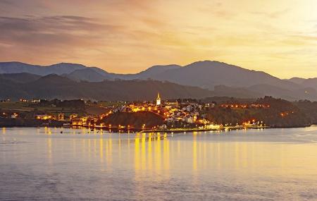
The Biosphere Reserve of Río Eo, Oscos and Terras de Burón was declared as such by UNESCO in 2007, making it the first community to be so designated outside the network of protected natural areas. It is also the first to be shared by two autonomous communities, Asturias and Galicia.

This Reserve covers seven Asturian municipalities and brings together a total of 1,600 km2, in which approximately 34,000 inhabitants live. They are territories united and linked by the fluvial axis of the river Eo and its mouth.
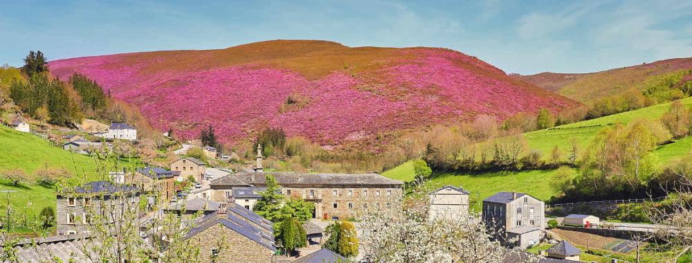
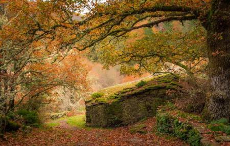
This area has a great variety of landscape units. In addition, its rich natural heritage associated with the mouth of the Eo and the valleys of the river basins that form the backbone of its space, allows you to enjoy beautiful beaches and steep cliffs. The optimal conservation of its forest formations are a good representation of the western Cantabrian mid-mountains, and no less important is the ethnographic and architectural wealth of the area.

In its declaration as a Biosphere Reserve, UNESCO recognises the work of the area's inhabitants in favour of sustainable development, which favours growth while respecting the conservation of landscapes, ecosystems, species and genetic diversity. It is a place framed by territories that have suffered the consequences of centuries of secular isolation, but which has been able to overcome thanks to the good use of opportunities for the development of pioneering projects in the international sphere, sustainability and rural tourism; all of this, together with its natural and environmental values, its landscape values, its economic activities and its cultural and ethnographic heritage, has allowed this area to continue advancing in progress and orderly and sustainable development. The landscape values of this area are undeniable, but above all its historical trajectory of social and economic action, as well as its heritage conservation, stand out.
The undeniable natural beauty of the Principality is evident in its five territories recognised as Biosphere Reserves, and in the fact that a third of its territory - 340,000 hectares - has some form of conservation status.
Plant life
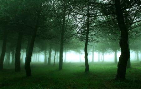
Of its rich and varied flora, the magnificent conservation of its forests stands out above all, due above all to the scarce communications that this area has had. The forests of oak, chestnut, birch and pine trees stand out, as well as the mixed forests, mainly made up of oak, chestnut and birch trees. The riverside forests also occupy an important space, made up of alder, willow and ash trees, as well as maple and hazelnut trees.
Other protected species such as holly and yew also appear in this natural area. Wild cherry, walnut and laurel trees complete the flora of the area. Among the shrub or bush species, broom, heather and strawberry trees stand out.
Wildlife
Wild boar, fox and roe deer are the most representative animals in this area of western Asturias, but small mammals such as otters, martens, martens, martens, civet cats, badgers and weasels are also very common in its forests, especially in areas with streams and rocky areas. Birds of prey such as the common buzzard, the bee-eater sparrowhawk and the common kestrel are the most common birds that fly over these skies.